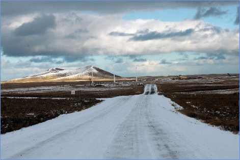
While the number of motor vehicle fatalities has been low over the past five years, the Pribilof Islands region has documented a higher number of serious injuries. In many areas there are no stop or yield signs, a lack of delineation between walking trails and motorized trails, and lighting is poor and limited.
Prevention of future roadway fatalities and serious injuries is of critical importance to our remote and isolated communities. Due to the lack of hospitals or trauma centers, patients with serious injuries must be airlifted or medevacked the nearly 800 miles to Anchorage. Medevacs can often be delayed due to persistently overcast skies, high winds, frequent cyclonic storms, and heavy fog.
With funding provided by the US Department of Transportation “Safe Streets and Roads For All” grant, a regional transportation safety action plan was developed by Kuna Engineering to identify actionable strategies towards reaching the goal of zero roadway fatalities and serious injuries, supported by a process of community engagement and attention to equity. Stakeholder engagement and a collaborative approach ensured the Transportation Safety Action Plan reflected the unique needs and perspectives of the Pribilof Island region, ultimately enhancing roadway safety and providing long-term safety initiatives that support the future growth and development.
Goal and Emphasis Areas
It is the goal and mission of the city government, tribal council, and community to see these emphasis areas developed in the future to continue to achieve ongoing transportation safety and a continuation of zero road deaths on community roadways.
Safety Action Plan Goals & Emphasis Areas:
- Commitment to a Vision Zero Plan of maintaining zero roadway deaths on community roads, walkways and trails.
- Use of the Safe Systems Approach in the development of the Safety Action Plan, which recognizes that humans make mistakes which can lead to crashes and that death and serious injuries on community transportation networks are unacceptable and that all community stakeholders have a shared responsibility to ensure serious and fatal crashes do not occur.
- Modernize and develop existing transportation infrastructure to provide safety improvements for all road users.
- Provide improved post-crash care in the event of crash so community members can access medical facilities and treatment in a timely manner.
- Integrate and include the Pribilof Island Unangan people and their input into future transportation safety improvements.
- Provide long-term transportation safety initiatives that can help support the future growth and development of the Pribilof Islands Region.
The stages of development of this plan are detailed below. Documents or data generated from each stage are also available to review below.
Project Kick-Off and Safety Action Plan Team (SAPT) Development
In December 2023 a Kick-Off meeting was held. A Safety Action Plan Team of project stakeholders was organized by January 2024. Members of this team included representatives of each community, city government, public works, public safety, tribal government and school district.Public Outreach and Engagement
Kuna Engineering ensured community feedback was collected and recorded at every stage of the process. Surveys, reports of feedback from public meetings as well as drafts of the report were made available to review through this site. The Story Map outlines key safety initiatives, improvement strategies, and regional goals to enhance transportation infrastructure and ensure safer travel across these remote communities.
Public Meeting and Site Assessment
Public meetings were held in Saint Paul throughout the process. Kuna Engineering visited and assessed the site and held public meetings in April 2024. A product of that meeting included The Transportation Safety Map —developed to include transportation infrastructure, crash data and crash sites on both Saint Paul and Saint George Island. The map is fully interactive and details crash locations, severity, dates, vehicle types, and other relevant details sourced from the City of Saint Paul Public Safety Office and the Saint George Transportation Safety Plan Click the link below to view it. In June 2024, a Kuna survey crew visited Saint Paul Island to capture drone imagery data. The team also collected survey monument locations for community mapping and implementation for the Transportation Safety Action Plan. This data was integrated into The Transportation Safety Map as well as the Saint Paul SS4A Action Plan Public Survey Feedback Map and the Saint George SS4A Action Plan Public Survey Feedback Map.


Draft Plan Public Review
Meetings were held in Saint Paul to review several drafts of plans — first to the City Council of Saint Paul. Feedback was incorporated into the draft and then presented to the community on three occasions for further feedback.Plan Adoption and Implementation
In Spring 2025, the Councils for both the City of Saint Paul and Tribal Government adopted the plan and began implementing the strategies and priorities outlined in the Project Matrix. The Project Matrix for future planned projects integrates a variety of strategies to achieve the goals of the safety action plan. This includes the implementation of policies, programs, and innovative practices, alongside low-cost, high-impact strategies that enhance overall safety. Specific construction projects in the matrix are outlined with clear scopes, budgets, and timeframes, ensuring that each initiative aligns with the broader objectives of improving transportation safety. Click on the Project Matrix for a breakdown of the table and specific emphasis areas, projects and actions that can be implemented in the long, medium and short term. The Pribilof Islands Regional Transportation Safety Action Plan is now complete. For updates on this and other transportation safety efforts, please visit the project updates and announcements page.Contact Information
The Safety Action Planning Team and the City of Saint Paul sincerely appreciate the feedback received throughout the planning process. Comments regarding the final plan are welcome and can be submitted to the project manager, Joseph Rolfzen (907) 339-6500 –JRolfzen@kunaeng.com.